SANTORINI
Santorini geography
SANTORINI
SANTORINI
Santorini geography
Santorini geomorphology is the result of hundreds of thousands of years of volcanic activity.
The island is located on top of the volcanic arc of the Aegean Sea which consists of a series of inactive or active volcanoes spanning approximately 500 km in length and 30-40 km in width. The arc extends from the eastern coast of Greece mainland, through to central Aegean Sea and ends at the western coast of Turkey.
The geology of Santorini presents a large variety and wealth.
Prevolcanic are the limestone layers in Prophet Elias, Monolithos, Gavrilos and the shale rocks in Athinios. Volcanic are the pyroclastics, the lava and the thick layers of Theran earth, which consist the ground of the island. It is as thick as 40 m in the flat land but it is thinner in highlands due to corrosion. It is fertile and favors crops where the economy of the island was based on prior to the development of tourism. Vines, cereals (barley mainly), legumes, fava and, in the older days, cotton have been the basic crops from ancient times.
Santorini is one of the most arid regions of the Aegean Sea, due to lack in underground wells and to very few rainfalls. The climate is temperate and the temperatures are quite high during winter, while in the summer the heat mitigates the wind. This time of season fogs keep moisture in the atmosphere, while many times south winds blow.
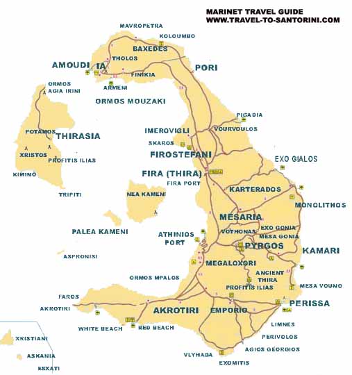
In its SE part is located the mountain of Prophet Elias with the homonymous monastery. Next to it is Mesa Vouno where ancient Thera is built.
The eastern side of the island slopes gently to the sea, lined with beaches of black volcanic sand.
* Source: "Santorini: And the sea brought forth the earth"/ Topio Publications/ From the text of archeologist Kiki Birtacha. |
| Please
share your opinion of it with other travelers. Write
a review! |